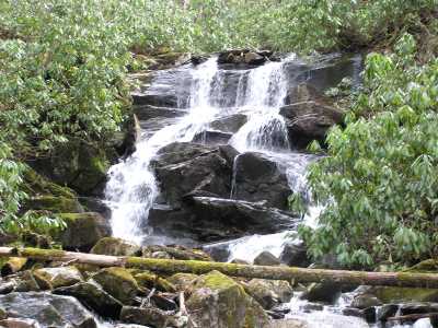 lower falls (elevation 4500')
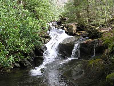 middle cascade (elevation 4700')
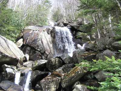 upper cascade (elevation 5200')
| WGS84 | |
| 35.589170 | -83.485280 |
| 35° 35.35'N | 83° 29.117'W |
| 35° 35' 21"N | 83° 29' 7"W |
| 17S 274829E 3941226N | |
| convert to NAD27 | |
MAPS
Select one of the following maps to display this waypoint (WGS84).
GPS
Remarks:
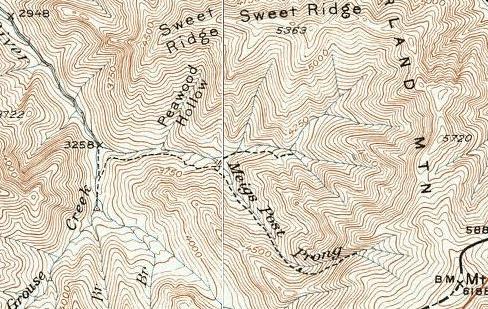
50' lower falls, several middle cascades, the waypoint is for
the top of the 400' upper cascade.
off-trail (see 1931 map)
lower falls (elevation 4500')
middle cascade (elevation 4700')
upper cascade (elevation 5200')
Named after an early surveyor (1700's).
nearby is Meigs Post Falls