
| Tennessee Regions |
| Waypoint | Region | County | Locale |
| HMX001 | North Chickamauga Cr. Gorge | Hamilton | info |
| GUX001 | Fiery Gizzard | Grundy | trails |
| GUX002 | Savage Gulf | Grundy | TNNA |
| WHX001 | Scott's Gulf | White | TNNA |
| FRX001 | Walls of Jericho | Franklin | TNC |
| CUX001 | Grassy Cove | Cumberland | BIG sinkhole |
| FRX002 | Buggytop Cave | Franklin | TNNA |
| BLX001 | Sequatchie Valley | Bledsoe | anticline |
| LAX001 | Reelfoot Lake | Lake | state park |
| JAX003 | The Boils | Jackson | |
| VBX001 | Crusher Hole | VanBuren | |
| HWX001 | Ebbing and Flowing Spring | Hawkins | |
| SVX002 | Fittified Spring | Sevier | GSMNP |
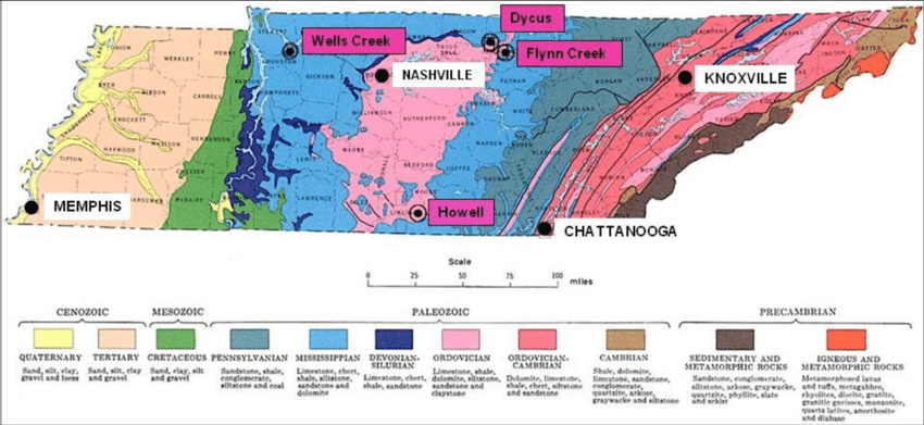
| JAX002 | Dycus Crater | Jackson | private |
| JAX001 | Flynn Creek Crater | Jackson | study |
| LIX001 | Howell Crater | Lincoln | info |
| STX001 | Wells Creek Crater | Stewart | info |
| UNX001 | Norris igneous rock | Union | Norris Lake |
| SVX001 | Smoky Mtns igneous rock | Sevier | GSMNP |
| SHX001 | Chickasaw Bluffs | Shelby |

")
Tennessee landforms
home
arches
waterfalls
rocks
peaks
balds
sinks
lakes
regions
county
GSMNP landforms (TN/NC)
BSF landforms (TN/KY)
©
Tom Dunigan
Revised
Thu, 06 Feb 2025 11:13:25 -0700