Tennessee Landforms -- arches and natural bridges| WGS84 |
| 36.284500 | -87.155300 |
| 36° 17.07'N | 87° 9.318'W |
| 36° 17' 4.2"N | 87° 9' 19.1"W |
| 16S 486054E 4015516N |
| convert to NAD27 |
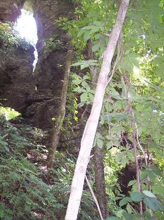
Harpeth Triple 5x11
Waypoint: CHA002 36.284500,-87.155300
County: Cheatham landforms of Cheatham county
NABSQNO 16S-486054-4015516
popup list of
nearby landforms (mileage, bearing)
MAPS
Select one of the following maps to display this waypoint (WGS84).
GPS
Remarks:
Reference & photo: Keith Garnes
Tennessee landforms
home
arches
waterfalls
rocks
peaks
balds
sinks
lakes
regions
county
GSMNP landforms (TN/NC)
BSF landforms (TN/KY)
or nearby
lookout towers
Chuck Sutherland's www.tnlandforms.com the future (2024)
 ©
Tom Dunigan
©
Tom Dunigan