East Tennessee mountain bike rides

So many trails, so little time.

The following are brief descriptions (plus maps and pictures) of various East Tennessee mountain bike rides. The rides range in difficulty from a "ride in the park" to wilderness adventures. Popular mountain biking rides in the Knoxville area are Panther Creek, Norris, Lone Mountain, and Haw Ridge. Here is a map of East Tenn. indicating where some of these places are, more or less. (Or, on a 3-D topo map ). We have GPS waypoints (.gpx), maps, and driving directions for some of the trail heads at trail-head parking. Many of the East Tennessee trail descriptions include GPS tracks and elevation profiles.

These pages describe ridable trails/roads over the last dozen years or so. Some trails/roads may be closed due to Mother Nature or new access restrictions. Please obey posted signs. Be aware of hunting seasons and try not to look like a deer. Check TWRA's Fall state hunt schedule (Units A and B, see TWRA state units map) and WMA hunt schedule. Also the Oak Ridge reservation is closed for fall hunts, see the Oak Ridge Reservation hunt page.

Cumberlands
Frozen Head State Park steep climb, fire tower
Lone Mountain State Forest nice single track
Caryville good views from Ash Log Mtn.
Royal Blue aMAZEing (WMA, access fee), fire tower
Fork Mountain north of 116 (private land)
Gobey
Indian Bluff "tallest" mountain (access fee)
Windrock three-mile descent, free-rider downhill (access fee)
Walden Ridge (private land, limited access)

Cumberland Plateau
Big South Fork water, sand, and horse mementos -- epic ride
Black Mountain caprock and trillium (private land)
Catoosa wild and scenic rivers (WMA), fire tower
Prentice Cooper NW of Chattanooga (WMA), fire tower

Oak Ridge (locator map and Visitor Bureau)
Haw Ridge mountain biker's gym, single track, trail runners delight
Gallaher Bend easy family ride
Melton Lake Greenway paved bike trail, extended to 5.6 miles, April, 2012
North Boundary road scenic gravel plus single track
Black Oak Ridge rolling scenic gravel plus some single track (BORCE)
Wiltshire a small, possibly endangered, species (private land)

Knoxville outdoorknoxville.com trails, greenways, parks
Big Foot Park CLOSED, private property
Concord Park single track
I. C. King Park rolling single track
Forks of the River WMA and Georgia Marble quarry trails
Hastie Park Dirty South trails being developed ...
AMBC's Knoxville trails Hastie, Georgia Marble, Baker Creek, Concord and AMBC favorite trails mtbproject, AMBC facebook
Baker Creek Preserve or here and youtube ride
Sharps Ridge trails under construction (2013), trails image or 2015 map trailhead at 36.0084524,-83.9321519
KTC trail runs

Cherokee National Forest
Horse Creek/Upper Paint Creek mountain streams, balds, and fire towers
Paint Creek Hurricane Gap, Chimney Rocks, French Broad
Citico/Tellico mountain streams, Cherohala
Starr Mountain fire tower
Ocoee Clemmer trail and Tanasi trails an IMBA epic ride

Great Smoky Mountains National Park
Rich Mountain/ Parson Branch variations on Cades Cove
Townsend Vee Hollow 14 miles of trails (video)
Foothills Parkway Townsend/Wear Cove, to be closed and Townsend/Alcoa/Maryville greenways or here
Mt Sterling/Cataloochee eastern edge of the Park and Max Patch/Harmon Den
Tsali "take a number" ... ok, so it's in North Carolina (access fee) -- epic ride

Other
Panther Creek State Park intro to mountain biking
Norris "dam" good trails
new Loyston Point trails and Hemlock Bluff (24+ miles) or here
Chuck Swan ... YAFT (yet another fire tower) (WMA)
Wears Bend rolling dirt roads (WMA)
Clinton Aspire Park single track (22 miles), pump track

Links authored by others
more info on rides in Chattanooga/Ocoee area Chilhowee, Chestnut, Edward's Pt
Raccoon Mountain trails or here or race course another map
Chattanooga's Enterpise South Nature Park trails opened 4/9/11, bout 10 miles of mtn bike trails, 2800 acres, see GPS track and elevation profile
Collegdale trails on White Oak Mountain or pdf map
Harrison Bay state park 4.4 mile loop
Cherokee National Forest mountain bike trails
Goat Trail Cowan/Sewanee or here and mountaingoattrail.org rails to trails
Sewanee perimeter trail
Franklin State Forest trails
Koerner's North Cumberland trails Google earth zip file windrock, royal blue
Chickasaw Trace county park, Columbia, Google map and park info
more tennessee trails
Northeast Tennessee rides Buffalo and Bays Mountain,     northeast TN mountain bike association NTMBA Warriors' Path State Park trails and Steele Creek Park
middle Tennessee and SORBA mid TN trails and nashvillemountainbike.com and Montgomery Bell Park trails (20 miles)
Fall Creek Fall state park mountain bike trails (21 miles)
Mousetail state park mountain bike trails (9 miles)
Tims Ford state park mountain bike trails (6 miles)
Big Hill Pond mountain bike/horse trails (10 miles)
Warriors Path state park mountain bike trails (9 miles)
Hamilton Creek trail Nashville
Land between the Lakes     other TN rides
Tennessee mountain bike trails
SORBA's list of Tennessee mountain bike trails
Tennessee trails trails.com or mtbreview.com
TN trails in americantrails.org
TN state parks biking
TrailLink TN mountain bike trails
TVA trails
North Carolina's Nantahala National Forest rides     Pisgah National Forest mountain bike trails
western north carolina rides, Pisgah, Nantahala, Dupont Forest see GPS track
Bent Creek NC and another map
Panthertown NC trails
Hayesville NC jackrabbit and GPS track
NC National Forests mountain bike trails
NC Kerr Scott trails and Rocky Knob trails
trails in the NC research triangle
Virginia Creeper and Google Earth data and rental/shuttle or here and GPS track/profile
Virgina: Beartree Campground area rides Iron Mountain other western Virginia rides
Virginia's epic ride, Southern Traverse
Virginia New River Trail State Park 57 miles (former railway)
Danville, Virgina's Anglers Ridge
Kentucky trails in Daniel Boone National Forest
singletracks.com TN, NC, SC, GA
N. Georgia     Carters Lake     Atlanta trails     Blankets Creek
Chicopee Woods Nature Prserve trail map or here
Georgia Silver Comet trail
Georgia pinhoti trail and Alabama, trail alliance
bike/skate trails Silver Comet, Virginia Creeper, Chief Ladiga, Wild Horse
South Carolina trails and FATS trails sorbascsra info/maps or FATS GPS track
mountain biking in Snow Shoe West Virginia     Greenbrier River Trail
Alabama more Alabama     Ladiga trail paved and here
SOR southeast mountain biking
Appalachian downhill mountain biking
missouri katy trail
IMBA epic rides
Mtn biking USA     GORP     Internet cycling     TrailSource
Indiana's Brown County trails
C&O canal bikepath or here or here
IMBA and NORBA and SORBA
National Mountain Bike Patrol
knoxville cycling forums or facebook
Tennessee mountain biking alliance blog and links
Kelley's Knoxville bike blog
Friends of Haw Ridge Park and Yahoo news group blog or twitter or Facebook
Tennessee landforms waterfalls, arches, balds, etc. (maps/waypoints) and lookout towers

Trail building/maintenance

trail building and maintenance more info on trail maintenance
IMBA/Haw Ridge trail school Apr, '03 and other IMBA trailschools
IMBA trail bridges
Wetlands Trail Design and Construction bridges, boardwalks, etc.
trail design and construction and bridge construction
trail tools pulaski, mcleod, etc. and IMBA's tool guide or here or or prohoe or rogue hoe or lamberton rake or forestry suppliers or Ben Meadows
Tim's chainsaw tips
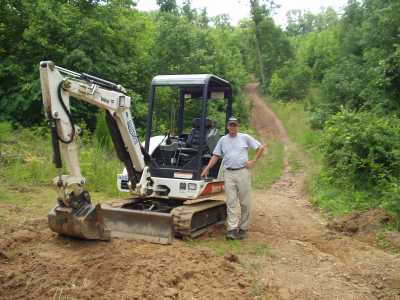
mechanized trail equipment
dingo 425
bobcat mt52
DitchWitch SK350 or SK500
sweco trail dozer or here trail dozer 4' blade or here
Singletrack 240
mini excavator
mechanized trail equipment Morrison trailblazer
bobcat 324 mini excavator variable undercarriage
ASV RC-30 rubber track loader and blog
Ocoee/Tanasi new trail construction Sweco and mini-excavator
traildynamics.com and ask woody
USFS trail construction manual $3/ft of trail cost reference
US DOT trail design and maintenance
AT trail work manuals
trail blazes guidelines
trail building books

Maps

Local bike stores may have maps and current access information. USGS quads can help with topography, but trails and jeep roads depicted on these maps often do not represent current conditions. USGS quadrangles can be obtained at hiking stores, map stores (Omni), and from the TVA map store (800-627-7882). Delorme's 3-D Topo Quads have USGS quardrangles on CDs with GPS support, as does Maptech's TerrainNavigator. mapquest and terraserver, and maptech have topos online. County maps may be of use for Wildlife Management Areas and general directions. You can get Wildlife Management Area maps at tnwildlifefoundation.org. Delorme's Tennessee Atlas & Gazetteer includes coarse topographic information and is available at book stores. David Moore's book Tennessee Mountain Bike Adventures has trail descriptions and maps for many areas of Tennessee. Also, see Parham's book Off the Beaten Track: Mountain Biking in Eastern Tennessee. And in 2009, see Colquitt/Livengood book on mountain biking in TN, Off Road Trails. Also see mountain biking books.

East Tennessee weather forecast or here, and historical weather stats. East Tennessee webcams.

Also visit the AMBC SORBA/Appalachian Mountain Bike Club page or their facebook and here are some Tennessee Bike Clubs.


http://tnlandforms.us/mtnbike maintained and © by Tom Dunigan
"How did you make those maps?" and GPS use.
Visitors to this page since Jan 1, 2002
and to all mtnbike/*.html
2252544 visitors since 1/1/97