| Private Land -- access by permission only |
In May of '97 "NO TRESPASSING" signs were posted on the gravel access road to the fire tower. Land along the ridge is privately owned by various folks. Access is now by permission only.
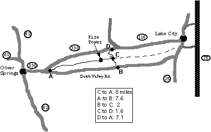
Description: Starting from (C), head southwest on the gravel road along the top of the ridge to the Laurel Grove fire tower (mile 1). From the fire tower, continue into the woods along the backbone of the ridge on a nice single track. At mile 4 you ride over the top of the Chester's 1960 bomb shelter. At about mile 8 where the trail descends under a power line, you can turn around and ride back, or continue down the rocky descent to the highway (A) (junction of 330 and Dutch Valley Rd).
The trail along the top of Walden Ridge (starting in Lake City) was to be part of the Cumberland Trail, but it didn't happen. The section from (C) to Lake City starts with a quarter mile of rock scrambling, but is impassable due to dead pines as of 2006.
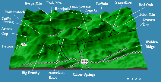
In 2008, a new segment of Walden Ridge trail from Oliver Springs west to TN 27 is being opened, see 13-mile loop