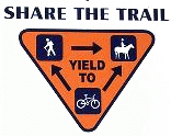
Discourteous and speeding bicyclists (speed limit 10 mph) are threatening future use of the watershed by bicyclists. Slow down and yield to horses/hikers!
Description:
The City of Norris watershed provides a collection of jeep roads and single track for offroad vehicles (no ATVs), bicyclists, equestrians, and hikers. The City does a super job grading and maintaining the dirt roads in this 2,300 acre wilderness. The trails/roads are over a hilly, karstic terrain (sinkholes and caves) through hardwood forests. The Appalachian Mountain Bike Club and many other volunteers have helped with trail development, maintenance, and signs.
From the pumping station (890'), the High Point jeep road climbs 1.8 miles to High Point (1460'). Ridgecrest trail, Freeway, and Longmire offer steep (300'+) single track to the west of High Point. Red Hill and Raccoon Run are more moderate double track. The Lakeside loop trail descends 300' to the edge of Norris Lake (1020'). The trail passes above a large sink hole that is full of water when the lake is at full pool. Easier loops can be found in the vicinity of the rifle range (1100') on Upper Clear Creek Rd.
Trails south of Clear Creek include East Trail, Reservoir Hill Trail (0.6), Reservoir Hill Loop (2.0), and it's about 0.9 miles to Observation Point from Reservoir Hill. Another 2.5 mile loop, south of Obersvation Point, includes Deer Ridge Rd and Eagle Trail. This loop passes through the small park next to the City building and can be accessed from mile post 8 on US 441.
The watershed is closed for various periods each fall for deer hunting. For 2024 the watershed will be closed for hunting Oct 19-27 and Nov 23 - Dec 1 Trails south of Clear Creek and the Park trails west of the dam remain open during the hunts. Some trails are designated for foot traffic only. Cliff trail and Grist Mill Trail are closed to cyclists. Trails are closed at dark -- no night riding.
A new trail (2009, map), Lake View Trail, 4.8 miles, runs west of the High Point Rd trail and joins the western portion of Lakeside Loop trail. The trail has connections at High Point and Camp Sam Trail. See city-side trails.
There are other park mountain bike trails (9.2 miles) on west side of the dam, Rock Creek 1.2, Hootin Hollow 1.1, Andrews Ridge 1.8, Sinkhole 0.8, Marine Railway 4.3, see park 2016 map. New Elkins and Chuckmore trails in 2016, read more.
Various trip reports (gps track maps and elevation profiles): 7/20/10 25K run
Description of Norris watershed trails. Info on city history here and here. TN sinkholes and the Anderson county sinkholes. The Eli Nine Sinkholes trail in the watershed passes by several sinkholes, but only one shows on the topo map. See GPS track of hike on watershed foot trails including Eli Nine sinkholes, another GPS hiking track and 2024 hike. Spring wildflower hike on River Bluff Trail (3.1 miles).
Near Andersonville are TVA's Loyston Point mountain bike trails and Hemlock Bluff hiking trail or here