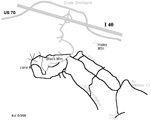
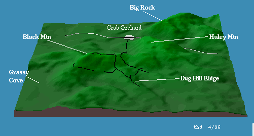
Click here for map ... good luck, also a 3-D map (24K).
Description: This is a popular hiking ( Cumberland Trail) and rock climbing area. No bikes or other vehicles are permitted on the Cumberland Trail. Off-road vehicles frequent the area, and there is a maze of jeep roads and ATV trails, making navigation difficult. Much of the land is private, so obey signs.
There are numerous loops and spurs on the south side of the mountain. You can visit Basin Falls. With a shuttle car east of White's Creek on Black Creek Road off of US27, you can ride 15 miles from Black Mtn through Dogwood and down the old stage road. You have to cross (wade/swim) White's Creek, so pick a dry time of the year.
Learn more about the history of Black Mountain. There are many interesting landforms around Black mountain.