
|
Private Land -- access fee required
In February, 2001, the Windrock ATV club in cooperation with Coal Creek Mining has opened the Windrock area to recreational use subject to a $17/day fee (or $88/year). Visit windrockatv.com for details. |
Description: Windrock is a rugged mountainous area laced with mining and logging roads and some ATV track. Areas may have hazards associated with mining (strip and deep). Most of the land is private and access rights may change -- obey posted signs and avoid active mining and logging areas. The Windrock trails include the portion of the Cumberland Mountains south of 116. Much of this area is quite remote, so you may not see another soul on your ride, and for the same reason, you may not be found for several days. During hunting season (Oct-Dec), try not to look like a deer.
Thanks to the strip-mining, you have good views of the Tennessee Valley to the south and Cumberland Mountain wilderness to the north. There are many more trails/roads than those described here. This describes the main gravel roads and trail segments. Think of it is as mountain bike trail kit from which you can build trips of varying length and altitude. Bet you can't eat just one! Here are some suggested trips.
A-B-C-D-A. A quickie loop (7.7 miles) for after-work riding that includes the three mile descent (C-D). Park at the church (A) and bicycle up (+1400') the broken pavement to where the pavement ends (B), and head east along the Windrock seam for 1.5 miles to (C), where the descent begins. The descent is a rutted and rough ATV/jeep road, but it has its fast moments. (As noted above, the entrance at A is now posted as access by written permission only.)
B-G-E-B. Park where the pavement ends and climb (+1000') to the radio towers. At Silvey Gap (2760', 1.5 miles from B), you can climb the dirt road to the right or continue up the gravel. The dirt road intersects gravel after 0.8 miles. To the left, climb to the radio towers (G, 3380'), or descend to the next right and ride to Sugar Tree Gap (E) and then follow the Windrock seam back to B. (Note, as of 12/96 there is active mining on the east face of the Pinacle just west of Sugar Tree Gap, the gnarly descent is now graded, but this area should be avoided.) From the radio towers, there are some mountain top rides to the northwest to Patterson Mtn, or the north to Hannah Top, or to the northeast along the top of Buffalo Mtn. for 8 miles to J.
B-F. A relatively flat ride along the Windrock seam. The ride passes through some old mine tipples. You can ride around the recent strip mine loop on Sassafras mountain (W).
B-G-H-L-K-Y-B. This is a loop down the north side to the coal washer (L) on 116. Another variation is B-G-I-M-K-Y-B. (As of spring of 1997, there is an active mine now between I-M, avoid this area. ) There is a wet-weather waterfall along T16 (Stony Flats).
|
|
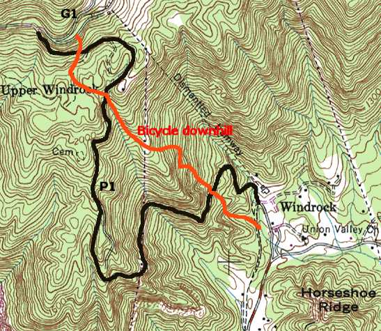
windrockbikepark.com There is a bone-breaker free-rider downhill from G1 down to the parking area (1.5 miles, 1600'). See map. Thanks to Joey Bridges and friends and Coal Creek Mining and Sean Leader bobcat work. Much appreciated by local free riders and orthopaedic surgeons! Sample pictures | |
ATV trails
In 2001, the Windrock ATV club began putting up trail marker posts. Here is a brief summary of the current trail markers.
| P1 | pavement that climbs from the parking area (A) at Union Valley Church. |
| G1 | Gravel following Windrock seam (B) and going east 8.8 miles to Graves Gap(F). |
| G2 | Gravel starting at (B) and climbing to the towers. |
| G3 | Gravel that climbs to Sugar Tree Gap (E) and active mining area at the Pinacle. |
| G4 | Gravel desending toward Ligias Fork from towers. |
| G5 | G1 except going west along Windrock seam (2.1 miles) and 116 (B-Y-K, 6.8 miles). |
| G6 | Gravel road descending to 116 (Y-K, 4.6 miles) at Rosemont (I-M, 5.6 miles). |
| T1 | New trail connecting parking area to T2 (1.2 miles). |
| T2 | Three mile descent off of G1 (C-B). |
| T3 | Trail starting at Flat Gap that follows a coal seam/bench around Wolf Ridge back to Silvery Gap (4.9 miles). |
| T4 | Bench trail around Toddy Mountain (2 miles). |
| T5 | Bench trail around American Knob from Flat Gap (wet, 1.5 miles). |
| T6 | Side trail off of T7 to G4. |
| T7 | Trail from Silvery Gap up to G4 (0.8 miles). |
| T8 | Trail off of Phillips Rd (Emily Cemetery) to Ligias Fork T12 (3 miles). |
| T9 | Trail descending 2.3 miles from G1 to Ligias Fork T12. |
| T10 | Descent from Pilot Mountain Loop (T11) to Ligias Fork (0.8 miles). |
| T11 | Bench loop trail around Pilot Mountain (Q) off of G1 (2.7 miles). |
| T12 | Trail along Ligias Fork to G4 (4 miles). |
| T13 | Trail from Sugar Tree Gap (G3) to G4 along old rail bed (wet, 2.8 miles). |
| T14 | Steep descent off of P1 (0.8 miles). |
| T15 | Side trail off west side of P1. |
| T16 | Stony Flat trail from G1 at Sasafras to T2 (5.1 miles). |
| T17 | Connector from T2 to T16 (0.7 miles). |
| T18 | Rattlesnake loop (4.1 miles) |
| T19 | Wolf Ridge middle bench (2.6 miles) |
| T20 | Upper Wolf Ridge loop (1.3 miles) |
| T21 | Indian Creek (2.8 miles) |
| T22 | Indian Creek west (0.5 miles) |
| T23 | Upper Pilot Mountain bench (0.5 miles) |
![]() Pictures:
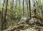
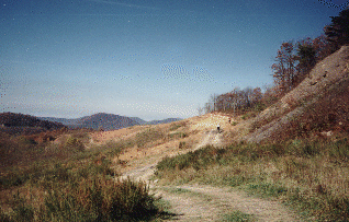
Windrock ,
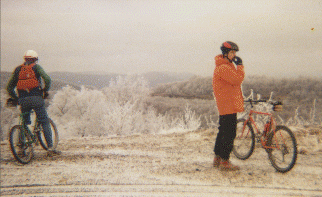
winter ride on Windrock ,
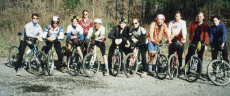
Windrock ascent team , 1990 and
route/elevation profile
and ride from Frozen Head to Caryville via Windrock
Pictures:
Windrock ,
winter ride on Windrock ,
Windrock ascent team , 1990 and
route/elevation profile
and ride from Frozen Head to Caryville via Windrock
Brief history of Coal
Creek watershed also see the book
Circling Windrock.
new
windmills for 2004, P1 has been paved in '04