Map legend/rules (2012)
Map legend/rules (2012)
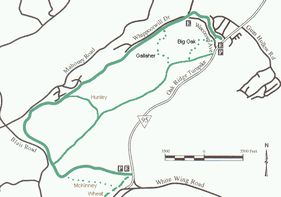
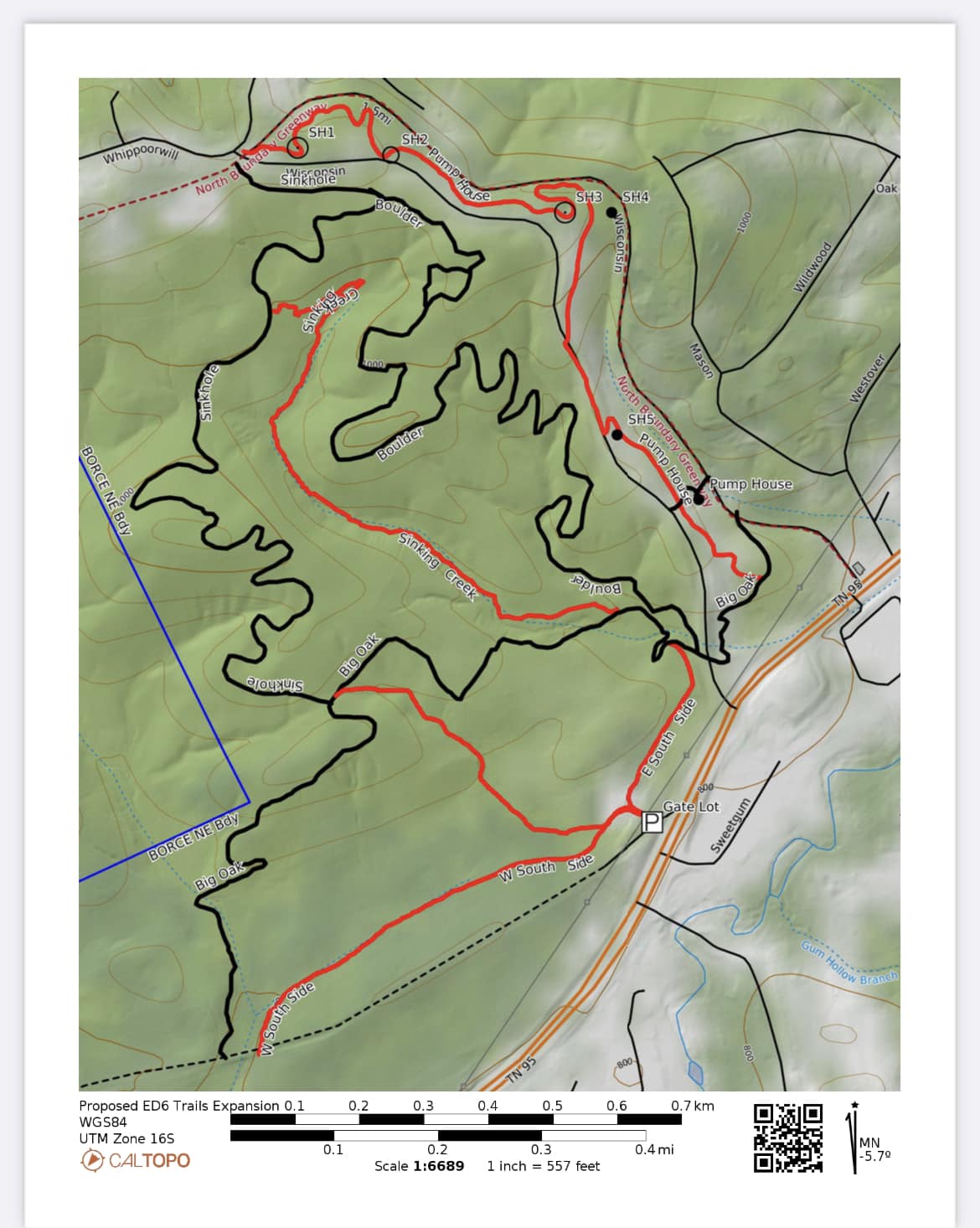
In 2005, Hunley Road and the remainder of Quarry Road were added to the greenway. Total loop is about 9.2 miles, more maps, elevation profiles, and info. In 2008, the Wheat District greenway (dashed green line, 1.2 miles) was opened along with the McKinney Ridge Trail (dotted green line, 1.3 miles, foot traffic only) near the west entrance to the North Boundary Greenway (see Google map). In March, 2009, the 1.3 miles Gallaher Trail was opened west of the water tower and descending to just west of Gallaher cemetery. As of March, 2011, the Gallaher Trail is for foot traffic only (state natural area). In Febrary, 2012, the 1.3 mile Big Oak Trail was constructed to provide a wooded, single-track connector from the east end of the lower gravel back to the guard shack, avoiding the turnpike. In 2015, the Sinkhole Trail was added, and in 2017 the Boulder Trail was added. See 2023 east North Boundary trails. See 2023 google map.
Beware. The area is closed for three spring weekend turkey hunts. For 2024, the area is closed April 13-14 and 20-21 and scout day 7 a.m. to noo n April 6. This area is closed for deer hunts three weekends each fall and several spring weekends for turkey hunts. Also see reservation hunt info. Oak Ridge fall deer hunts for 2023 are Nov 4-5, 11-12, Dec 9-10, In addition, the area is closed the Saturday before each scheduled hunt weekend for scouting.
See 1941 Bethel Valley topo on the USGS national topo map viewer to see old roads and structures (geopdf).