 Washington/Unicoi county line
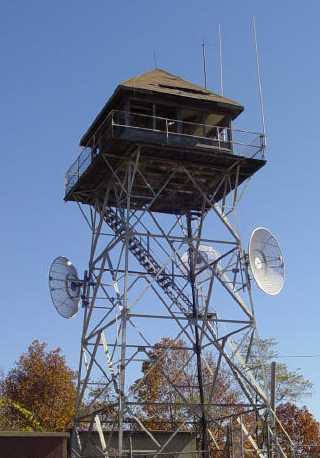
more info and photo, and Washington county high point and fund raising is underway to rehabilitate the tower (11/07). Another article and here and TEHCC info
Tom Owen's photo
| WGS84 | |
| 36.2171 | -82.3703 |
| 36° 13.026'N | 82° 22.218'W |
| 36° 13' 1.6"N | 82° 22' 13.1"W |
| 17S 376834E 4008899N | |
| convert to NAD27 | |
MAPS
Select one of the following maps to display this waypoint (WGS84).
GPS
Remarks:
Washington/Unicoi county line
more
info and photo, and
Washington county high point
and
fund raising is underway to rehabilitate the tower (11/07).
Another article
and
here
and
TEHCC info
Tom Owen's photo
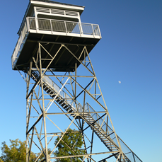
Dave Aldrige 2011 photo of refurbished tower