| WGS84 | |
| 35.69659 | -83.6099 |
| 35° 41.795'N | 83° 36.594'W |
| 35° 41' 47.7"N | 83° 36' 35.6"W |
| 17S 263852E 3953437N | |
| convert to NAD27 | |
MAPS
Select one of the following maps to display this waypoint (WGS84).
GPS
Remarks:
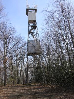
At end of Laurel Falls trail, the tower is now an air quality monitoring station, see current weather at the tower, or here or NHLR info.
See Dutch Roth old black & white
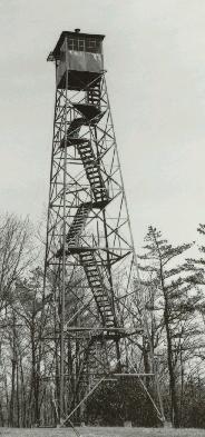 photo from NPS archives courtesy of Peter Barr
high winds at Cove Mountain and camp creek
read about wind waves at Cove Mountain and Camp Creek (Greene County) and 135-foot wind tower at Camp Creek. Camp Creek wind data NOAA. Camp Creek elementary school at 36.060026,-82.764625