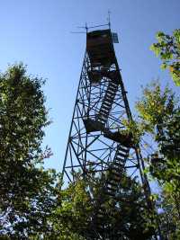
 and see old Dutch Roth
photo
and see old Dutch Roth
photo
| WGS84 | |
| 35.48546 | -83.8151 |
| 35° 29.128'N | 83° 48.906'W |
| 35° 29' 7.7"N | 83° 48' 54.4"W |
| 17S 244610E 3930525N | |
| convert to NAD27 | |
MAPS
Select one of the following maps to display this waypoint (WGS84).
GPS
Remarks:
and see old Dutch Roth
photo
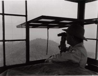 1957 NPS photo
panorama video
Help restore Shuckstack Tower, visit saveshuckstack.com
Google photos