Tennessee lookout towers | WGS84 |
| 35.30165 | -84.11585 |
| 35° 18.099'N | 84° 6.951'W |
| 35° 18' 5.9"N | 84° 6' 57.1"W |
| 16S 762251E 3910313N |
| convert to NAD27 |
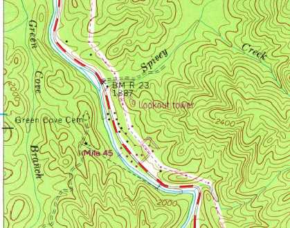
Green Cove
Waypoint: MOT005 35.30165,-84.11585
County: Monroe
Elevation: 2042'
Info: removed
popup list of
nearby towers (mileage, bearing)
or
nearby landforms
MAPS
Select one of the following maps to display this waypoint (WGS84).
GPS
Remarks:
 1957 Big Junction topo
Tennessee lookout towers

BSF landforms (TN/KY)
GSMNP landforms (TN/NC)
Tennessee landforms
home
arches
waterfalls
rocks
peaks
balds
sinks
lakes
regions
county
 ©
Tom Dunigan
©
Tom Dunigan