 c.1900
| WGS84 | |
| 35.0193 | -85.2634 |
| 35° 1.158'N | 85° 15.804'W |
| 35° 1' 9.5"N | 85° 15' 48.2"W |
| 16S 658439E 3876561N | |
| convert to NAD27 | |
MAPS
Select one of the following maps to display this waypoint (WGS84).
GPS
Remarks:
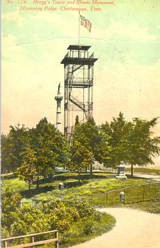
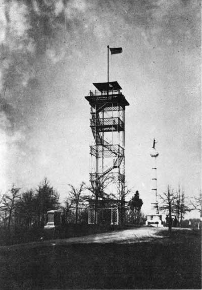
At one time a 75' observation tower on Missionary Ridge built in 1893 as a Civil War memorial on Missionary Ridge where Bragg's headquarters were located, see article and history Another tower was built at DeLong Reservation, and towers were planned for Tunnel Hill and Orchard Knob as memorials to Battle of Missionary Ridge. Tower was moved to Fall Creek Falls in 1943, see Bradden Knob tower.
c.1900