Tennessee lookout towers | WGS84 |
| 36.5319 | -84.806 |
| 36° 31.914'N | 84° 48.36'W |
| 36° 31' 54.8"N | 84° 48' 21.6"W |
| 16S 696418E 4045186N |
| convert to NAD27 |
Pickett
Waypoint: FET004 36.5319,-84.806
County: Fentress
Elevation: 1720'
Info: standing
popup list of
nearby towers (mileage, bearing)
or
nearby landforms
MAPS
Select one of the following maps to display this waypoint (WGS84).
GPS
Remarks:
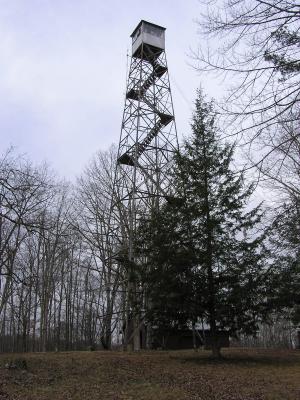 moved from nearby Rock House
location
moved from nearby Rock House
location
Tennessee lookout towers

BSF landforms (TN/KY)
GSMNP landforms (TN/NC)
Tennessee landforms
home
arches
waterfalls
rocks
peaks
balds
sinks
lakes
regions
county
 ©
Tom Dunigan
©
Tom Dunigan