Tennessee lookout towers | WGS84 |
| 35.86593 | -85.97605 |
| 35° 51.956'N | 85° 58.563'W |
| 35° 51' 57.4"N | 85° 58' 33.8"W |
| 16S 592443E 3969562N |
| convert to NAD27 |
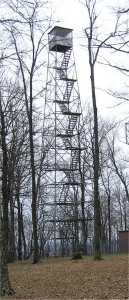
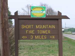
Short Mountain
Waypoint: CNT001 35.86593,-85.97605
County: Cannon
Elevation: 2092'
Info: 5-4 standing
popup list of
nearby towers (mileage, bearing)
or
nearby landforms
MAPS
Select one of the following maps to display this waypoint (WGS84).
GPS
Remarks:
See
state natural area
and county high point
and TN peaks of promience
Tennessee lookout towers

BSF landforms (TN/KY)
GSMNP landforms (TN/NC)
Tennessee landforms
home
arches
waterfalls
rocks
peaks
balds
sinks
lakes
regions
county
 ©
Tom Dunigan
©
Tom Dunigan