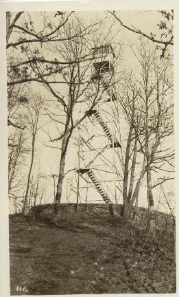
1930 photos from NPS archives courtesy of Peter Barr
| WGS84 | |
| 35.62872 | -83.78518 |
| 35° 37.723'N | 83° 47.111'W |
| 35° 37' 43.4"N | 83° 47' 6.7"W |
| 17S 247774E 3946343N | |
| convert to NAD27 | |
MAPS
Select one of the following maps to display this waypoint (WGS84).
GPS
Remarks:
1930 photos from NPS archives courtesy of Peter Barr
Only footers remain. VABM benchmark disk about 200' to the southeast at elevation 3686', disk in concrete post. See GSMNP peaks GPS elevation survey