| WGS84 | |
| 35.6327 | -83.9429 |
| 35° 37.962'N | 83° 56.574'W |
| 35° 37' 57.7"N | 83° 56' 34.4"W |
| 17S 233501E 3947200N | |
| convert to NAD27 | |
MAPS
Select one of the following maps to display this waypoint (WGS84).
GPS
Remarks:
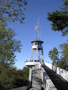
Observation tower along Foothills Parkway with web cam and air quality station at Look Rock.
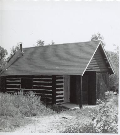
1966 photos from NPS archives courtesy of Peter Barr