Enter street,city,state or zip code or lat,-lon (dd.ddd)
(for other lat/lon encodings or UTM or NAD27 use this)
Distance buttons:
left click on map to make a track
this button will popup a window from which you can save the track as a
file.gpx for uploading to your GPS.
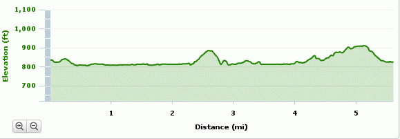
The City has funding for extending the
Melton Lake Greenway from
the southern end on to
Haw Ridge Park and west to the Haw Ridge
kiosk/parking area.
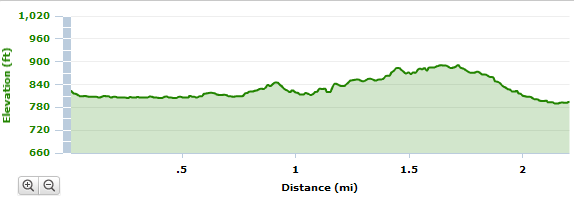
This should add about 2.2 miles of 10'-wide asphalt greenway to the Melton
Lake Greenway.
Along the lake there will be concrete and a boardwalk over the "wetlands".
The west-end parking area will be paved as part of the project.
Construction started in June, 2011 and completed April, 2012.