Tennessee Landforms -- waterfalls| WGS84 |
| 36.201200 | -82.418400 |
| 36° 12.072'N | 82° 25.104'W |
| 36° 12' 4.3"N | 82° 25' 6.2"W |
| 17S 372485E 4007197N |
| convert to NAD27 |
Dry Creek Falls 4'
Waypoint: WSF009 36.201200,-82.418400
County: Washington landforms of Washington county
popup list of
nearby landforms (mileage, bearing)
MAPS
Select one of the following maps to display this waypoint (WGS84).
GPS
Remarks:
Reference: directions and photo
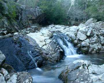 photo and coordinates courtesy of Bill Stowell
Tennessee landforms
home
arches
waterfalls
rocks
peaks
balds
sinks
lakes
regions
county
GSMNP landforms (TN/NC)
BSF landforms (TN/KY)
or nearby
lookout towers
Chuck Sutherland's www.tnlandforms.com the future (2024)
 ©
Tom Dunigan
©
Tom Dunigan