Tennessee Landforms -- waterfalls| WGS84 |
| 36.189500 | -82.448600 |
| 36° 11.37'N | 82° 26.916'W |
| 36° 11' 22.2"N | 82° 26' 55"W |
| 17S 369750E 4005939N |
| convert to NAD27 |
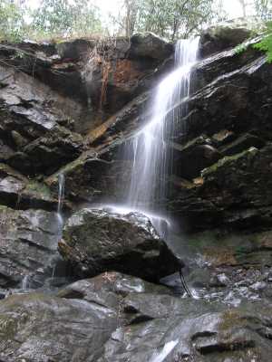
Millstone Creek Falls 30'
Waypoint: WSF002 36.189500,-82.448600
County: Washington landforms of Washington county
Locale: private
popup list of
nearby landforms (mileage, bearing)
MAPS
Select one of the following maps to display this waypoint (WGS84).
GPS
Remarks:
Tennessee landforms
home
arches
waterfalls
rocks
peaks
balds
sinks
lakes
regions
county
GSMNP landforms (TN/NC)
BSF landforms (TN/KY)
or nearby
lookout towers
Chuck Sutherland's www.tnlandforms.com the future (2024)
 ©
Tom Dunigan
©
Tom Dunigan