Tennessee Landforms -- waterfalls| WGS84 |
| 36.050608 | -85.407460 |
| 36° 3.036'N | 85° 24.448'W |
| 36° 3' 2.2"N | 85° 24' 26.9"W |
| 16S 643446E 3990735N |
| convert to NAD27 |
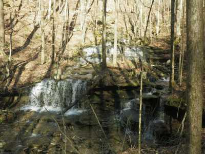
Faye Falls 9'
Waypoint: WHF027 36.050608,-85.407460
County: White landforms of White county
popup list of
nearby landforms (mileage, bearing)
MAPS
Select one of the following maps to display this waypoint (WGS84).
GPS
Remarks:
Reference and photo: Chuck Sutherland
Tennessee landforms
home
arches
waterfalls
rocks
peaks
balds
sinks
lakes
regions
county
GSMNP landforms (TN/NC)
BSF landforms (TN/KY)
or nearby
lookout towers
Chuck Sutherland's www.tnlandforms.com the future (2024)
 ©
Tom Dunigan
©
Tom Dunigan