Tennessee Landforms -- waterfalls| WGS84 |
| 35.838400 | -85.330590 |
| 35° 50.304'N | 85° 19.835'W |
| 35° 50' 18.2"N | 85° 19' 50.1"W |
| 16S 650773E 3967311N |
| convert to NAD27 |
Virgin Falls 100'
Waypoint: WHF015 35.838400,-85.330590
County: White landforms of White county
Locale: PktWldns
popup list of
nearby landforms (mileage, bearing)
MAPS
Select one of the following maps to display this waypoint (WGS84).
GPS
Remarks:
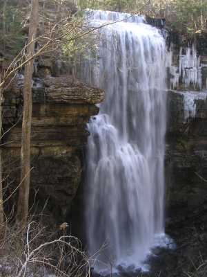
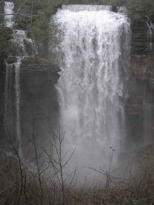
A natural bridge spans the creek at the top of the falls, and
there is a small span in the pit, ref WHA002.
Also see trail info/maps
and GPS track
google map/profile
or garmin
state natural area
Tennessee landforms
home
arches
waterfalls
rocks
peaks
balds
sinks
lakes
regions
county
GSMNP landforms (TN/NC)
BSF landforms (TN/KY)
or nearby
lookout towers
Chuck Sutherland's www.tnlandforms.com the future (2024)
 ©
Tom Dunigan
©
Tom Dunigan