Tennessee Landforms -- waterfalls| WGS84 |
| 35.841896 | -85.325030 |
| 35° 50.514'N | 85° 19.502'W |
| 35° 50' 30.8"N | 85° 19' 30.1"W |
| 16S 651269E 3967708N |
| convert to NAD27 |
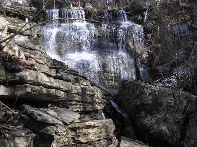
Sheep Falls 90'
Waypoint: WHF014 35.841896,-85.325030
County: White landforms of White county
Locale: PktWldns
popup list of
nearby landforms (mileage, bearing)
MAPS
Select one of the following maps to display this waypoint (WGS84).
GPS
Remarks:
Tennessee landforms
home
arches
waterfalls
rocks
peaks
balds
sinks
lakes
regions
county
GSMNP landforms (TN/NC)
BSF landforms (TN/KY)
or nearby
lookout towers
Chuck Sutherland's www.tnlandforms.com the future (2024)
 ©
Tom Dunigan
©
Tom Dunigan