Tennessee Landforms -- waterfalls| WGS84 |
| 35.853691 | -85.238104 |
| 35° 51.221'N | 85° 14.286'W |
| 35° 51' 13.3"N | 85° 14' 17.2"W |
| 16S 659096E 3969154N |
| convert to NAD27 |
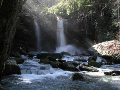
Puncheon Camp Cr Twin Falls 35'
Waypoint: WHF013 35.853691,-85.238104
County: White landforms of White county
Locale: ScottsGulf
popup list of
nearby landforms (mileage, bearing)
MAPS
Select one of the following maps to display this waypoint (WGS84).
GPS
Remarks:
off-trail
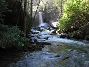
another
picture
and trail
narrative
nearby is Rogers Creek Falls
Tennessee landforms
home
arches
waterfalls
rocks
peaks
balds
sinks
lakes
regions
county
GSMNP landforms (TN/NC)
BSF landforms (TN/KY)
or nearby
lookout towers
Chuck Sutherland's www.tnlandforms.com the future (2024)
 ©
Tom Dunigan
©
Tom Dunigan