| WGS84 | |
| 35.841860 | -85.361710 |
| 35° 50.512'N | 85° 21.703'W |
| 35° 50' 30.7"N | 85° 21' 42.2"W |
| 16S 647956E 3967647N | |
| convert to NAD27 | |
MAPS
Select one of the following maps to display this waypoint (WGS84).
GPS
Remarks:
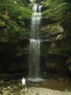
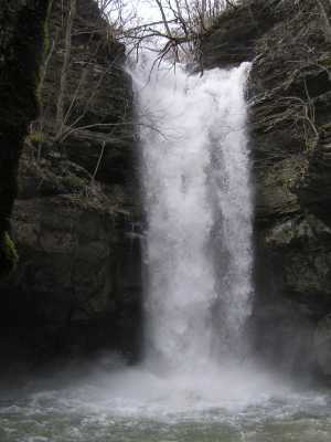
The water emerges from a cave, plunges 60' and disappears. At the base of the falls is a small arch/tunnel and some small column arches at the top (resurgence). Dodson cave is on the east wall of the sink hole.
In 1993, Walt Disney filmed portions of its movie, the Jungle Book, in the Lost Creek sinkhole. Disney's special effects team erected a 20-foot high styrofoam Hindu temple lion in the entrance of the cave and installed a sophisticated monorail system on one slope of the sinkhole. After the movie, the monorail was dismantled, but the lion was rescued by a Cookeville fraternity house to serve as its mascot.
Now a part of Fall Creek Falls state park
Chuck Sutherland HDR photo