Tennessee Landforms -- waterfalls| WGS84 |
| 35.849979 | -85.344960 |
| 35° 50.999'N | 85° 20.698'W |
| 35° 50' 59.9"N | 85° 20' 41.9"W |
| 16S 649453E 3968574N |
| convert to NAD27 |
Dry Creek Falls (3) 35'
Waypoint: WHF005 35.849979,-85.344960
County: White landforms of White county
Locale: ScottsGulf
popup list of
nearby landforms (mileage, bearing)
MAPS
Select one of the following maps to display this waypoint (WGS84).
GPS
Remarks:
off-trail
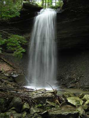 main falls 35'
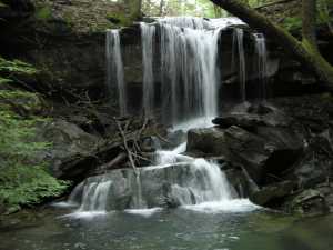 upper falls 17'
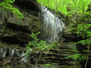 downstream, 16' side feeder falls at
35.8408 -85.3556
downstream, 16' side feeder falls at
35.8408 -85.3556
Chuck Sutherland
HDR photo
Tennessee landforms
home
arches
waterfalls
rocks
peaks
balds
sinks
lakes
regions
county
GSMNP landforms (TN/NC)
BSF landforms (TN/KY)
or nearby
lookout towers
Chuck Sutherland's www.tnlandforms.com the future (2024)
 ©
Tom Dunigan
©
Tom Dunigan