Tennessee Landforms -- waterfalls| WGS84 |
| 35.782440 | -85.683070 |
| 35° 46.946'N | 85° 40.984'W |
| 35° 46' 56.8"N | 85° 40' 59"W |
| 16S 619020E 3960618N |
| convert to NAD27 |
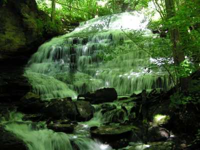
Toombe Falls 30'
Waypoint: WAF010 35.782440,-85.683070
County: Warren landforms of Warren county
Locale: Collins
popup list of
nearby landforms (mileage, bearing)
MAPS
Select one of the following maps to display this waypoint (WGS84).
GPS
Remarks:
Tennessee landforms
home
arches
waterfalls
rocks
peaks
balds
sinks
lakes
regions
county
GSMNP landforms (TN/NC)
BSF landforms (TN/KY)
or nearby
lookout towers
Chuck Sutherland's www.tnlandforms.com the future (2024)
 ©
Tom Dunigan
©
Tom Dunigan