Tennessee Landforms -- waterfalls| WGS84 |
| 35.808877 | -85.635316 |
| 35° 48.533'N | 85° 38.119'W |
| 35° 48' 32"N | 85° 38' 7.1"W |
| 16S 623296E 3963610N |
| convert to NAD27 |
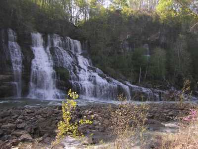
Twin Falls 80'
Waypoint: WAF004 35.808877,-85.635316
County: Warren landforms of Warren county
Locale: state park
popup list of
nearby landforms (mileage, bearing)
MAPS
Select one of the following maps to display this waypoint (WGS84).
GPS
Remarks:
The lake (Collins River) leaks thru the limestone wall
below the dam -- a man-made
incise meander just below Great Falls.
Tennessee landforms
home
arches
waterfalls
rocks
peaks
balds
sinks
lakes
regions
county
GSMNP landforms (TN/NC)
BSF landforms (TN/KY)
or nearby
lookout towers
Chuck Sutherland's www.tnlandforms.com the future (2024)
 ©
Tom Dunigan
©
Tom Dunigan