Tennessee Landforms -- waterfalls| WGS84 |
| 35.778711 | -85.706973 |
| 35° 46.723'N | 85° 42.418'W |
| 35° 46' 43.4"N | 85° 42' 25.1"W |
| 16S 616865E 3960176N |
| convert to NAD27 |
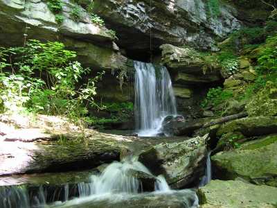
King Cascade 15'
Waypoint: WAF001 35.778711,-85.706973
County: Warren landforms of Warren county
Locale: Collins
popup list of
nearby landforms (mileage, bearing)
MAPS
Select one of the following maps to display this waypoint (WGS84).
GPS
Remarks:
Tumbles into the Collins River, see pics
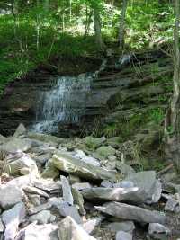 15' wet-weather cascacde downstream at
35.77846 -85.70504
15' wet-weather cascacde downstream at
35.77846 -85.70504
Tennessee landforms
home
arches
waterfalls
rocks
peaks
balds
sinks
lakes
regions
county
GSMNP landforms (TN/NC)
BSF landforms (TN/KY)
or nearby
lookout towers
Chuck Sutherland's www.tnlandforms.com the future (2024)
 ©
Tom Dunigan
©
Tom Dunigan