Tennessee Landforms -- waterfalls| WGS84 |
| 35.735121 | -85.350838 |
| 35° 44.107'N | 85° 21.05'W |
| 35° 44' 6.4"N | 85° 21' 3"W |
| 16S 649137E 3955824N |
| convert to NAD27 |
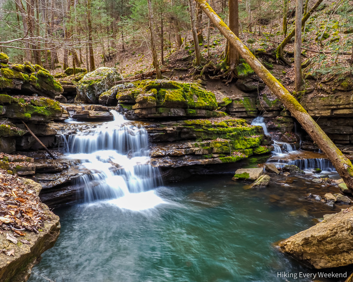
Hemlock Falls(2) 8'
Waypoint: VBF017 35.735121,-85.350838
County: VanBuren landforms of VanBuren county
Locale: state park
popup list of
nearby landforms (mileage, bearing)
MAPS
Select one of the following maps to display this waypoint (WGS84).
GPS
Remarks:
Reference and
photo courtesy of Dana Koogler.
Part of Fall Cr Falls state park
salah ayoupi reports a nearby Selah Falls at
35.734342, -85.349283
 Selah Falls
Tennessee landforms
home
arches
waterfalls
rocks
peaks
balds
sinks
lakes
regions
county
GSMNP landforms (TN/NC)
BSF landforms (TN/KY)
or nearby
lookout towers
Chuck Sutherland's www.tnlandforms.com the future (2024)
 ©
Tom Dunigan
©
Tom Dunigan