| WGS84 | |
| 35.730200 | -85.387900 |
| 35° 43.812'N | 85° 23.274'W |
| 35° 43' 48.7"N | 85° 23' 16.4"W |
| 16S 645794E 3955222N | |
| convert to NAD27 | |
MAPS
Select one of the following maps to display this waypoint (WGS84).
GPS
Remarks:
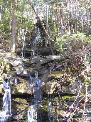
Reference & photo: Dwight Haston
Wet-weather cascade named for the Burdin Wheeler family who lived there in 1855-1930. Their plantation was swept away by the great flood of 1929. Their family cemetery and buildings were wiped away without a trace. The Cascade Falls drops 120 feet in a 75 foot space. The drop of the falls is only 25'. Wheeler had a whiskey still at the bottom of the falls. Nearby is Medley Arch.
Chuck Sutherland photo also look for Wheeler Falls in album
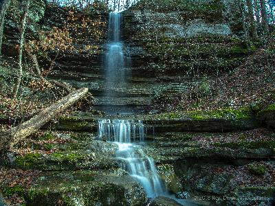 Ron Durant photo of a 35' falls about 200 yds north at 35.731583,-85.388883