Tennessee Landforms -- waterfalls| WGS84 |
| 35.726820 | -85.480540 |
| 35° 43.609'N | 85° 28.832'W |
| 35° 43' 36.5"N | 85° 28' 49.9"W |
| 16S 637421E 3954714N |
| convert to NAD27 |
Sullivan Falls 100'
Waypoint: VBF008 35.726820,-85.480540
County: VanBuren landforms of VanBuren county
Locale: private
popup list of
nearby landforms (mileage, bearing)
MAPS
Select one of the following maps to display this waypoint (WGS84).
GPS
Remarks:
Reference and photo: Dwight Haston
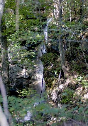
Dana Koogler's photo main drop
Tennessee landforms
home
arches
waterfalls
rocks
peaks
balds
sinks
lakes
regions
county
GSMNP landforms (TN/NC)
BSF landforms (TN/KY)
or nearby
lookout towers
Chuck Sutherland's www.tnlandforms.com the future (2024)
 ©
Tom Dunigan
©
Tom Dunigan