Tennessee Landforms -- waterfalls| WGS84 |
| 35.673060 | -85.384170 |
| 35° 40.384'N | 85° 23.05'W |
| 35° 40' 23"N | 85° 23' 3"W |
| 16S 646236E 3948890N |
| convert to NAD27 |
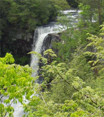
Piney Creek Falls 95'
Waypoint: VBF006 35.673060,-85.384170
County: VanBuren landforms of VanBuren county
Locale: state park
popup list of
nearby landforms (mileage, bearing)
MAPS
Select one of the following maps to display this waypoint (WGS84).
GPS
Remarks:
Tennessee landforms
home
arches
waterfalls
rocks
peaks
balds
sinks
lakes
regions
county
GSMNP landforms (TN/NC)
BSF landforms (TN/KY)
or nearby
lookout towers
Chuck Sutherland's www.tnlandforms.com the future (2024)
 ©
Tom Dunigan
©
Tom Dunigan