| WGS84 | |
| 35.727120 | -85.386600 |
| 35° 43.627'N | 85° 23.196'W |
| 35° 43' 37.6"N | 85° 23' 11.8"W |
| 16S 645917E 3954883N | |
| convert to NAD27 | |
MAPS
Select one of the following maps to display this waypoint (WGS84).
GPS
Remarks:
References: JNAD:TENN-30, C/P:17, WAD:44.2
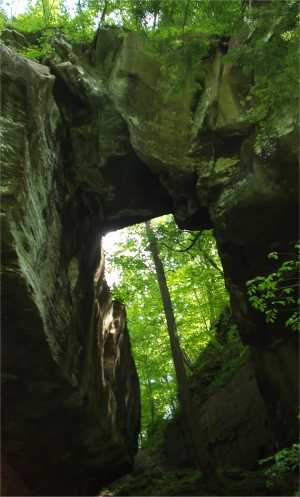
This big arch lies between two huge sinkholes in the Cane Creek Gulf, which is now a part of Fall Creek Falls State Park. A gated jeep road will get you close, then you'll have to go off-trail.
Chuck Sutherland's HDR photo