Tennessee Landforms -- waterfalls| WGS84 |
| 36.133000 | -82.335900 |
| 36° 7.98'N | 82° 20.154'W |
| 36° 7' 58.8"N | 82° 20' 9.2"W |
| 17S 379798E 3999527N |
| convert to NAD27 |
Rock Creek SB Falls 15'
Waypoint: UCF033 36.133000,-82.335900
County: Unicoi landforms of Unicoi county
Locale: Cherokee National Forest
popup list of
nearby landforms (mileage, bearing)
MAPS
Select one of the following maps to display this waypoint (WGS84).
GPS
Remarks:
Reference: Bill Stowell and his
photo
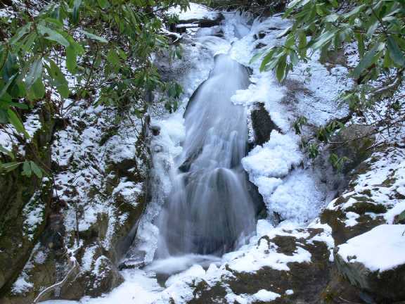 Dave Aldridge photo
Tennessee landforms
home
arches
waterfalls
rocks
peaks
balds
sinks
lakes
regions
county
GSMNP landforms (TN/NC)
BSF landforms (TN/KY)
or nearby
lookout towers
Chuck Sutherland's www.tnlandforms.com the future (2024)
 ©
Tom Dunigan
©
Tom Dunigan