Tennessee Landforms -- waterfalls| WGS84 |
| 36.127200 | -82.323600 |
| 36° 7.632'N | 82° 19.416'W |
| 36° 7' 37.9"N | 82° 19' 25"W |
| 17S 380896E 3998868N |
| convert to NAD27 |
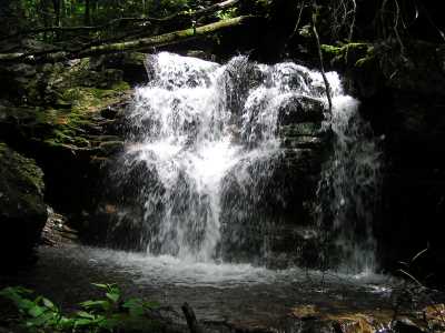
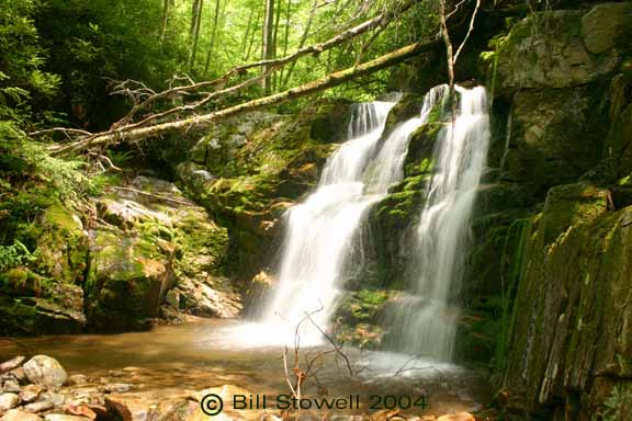
Rock Creek Falls (m) 15'
Waypoint: UCF014 36.127200,-82.323600
County: Unicoi landforms of Unicoi county
Locale: Cherokee National Forest
popup list of
nearby landforms (mileage, bearing)
MAPS
Select one of the following maps to display this waypoint (WGS84).
GPS
Remarks:
Reference: Bill Stowell
Tennessee landforms
home
arches
waterfalls
rocks
peaks
balds
sinks
lakes
regions
county
GSMNP landforms (TN/NC)
BSF landforms (TN/KY)
or nearby
lookout towers
Chuck Sutherland's www.tnlandforms.com the future (2024)
 ©
Tom Dunigan
©
Tom Dunigan