Tennessee Landforms -- waterfalls| WGS84 |
| 36.089000 | -82.533700 |
| 36° 5.34'N | 82° 32.022'W |
| 36° 5' 20.4"N | 82° 32' 1.3"W |
| 17S 361922E 3994909N |
| convert to NAD27 |
Lower Higgins Cr Falls(3+) 100'
Waypoint: UCF007 36.089000,-82.533700
County: Unicoi landforms of Unicoi county
Locale: Cherokee National Forest
popup list of
nearby landforms (mileage, bearing)
MAPS
Select one of the following maps to display this waypoint (WGS84).
GPS
Remarks:
Reference: Bill Stowell
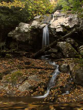
More falls further upstream at
36.0912166 -82.5372
and a 50' falls at
36.092133333 -82.5382333
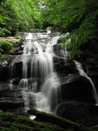
 Marty Silver's photos
Tennessee landforms
home
arches
waterfalls
rocks
peaks
balds
sinks
lakes
regions
county
GSMNP landforms (TN/NC)
BSF landforms (TN/KY)
or nearby
lookout towers
Chuck Sutherland's www.tnlandforms.com the future (2024)
 ©
Tom Dunigan
©
Tom Dunigan