| WGS84 | |
| 35.581400 | -83.483800 |
| 35° 34.884'N | 83° 29.028'W |
| 35° 34' 53"N | 83° 29' 1.7"W |
| 17S 274941E 3940361N | |
| convert to NAD27 | |
MAPS
Select one of the following maps to display this waypoint (WGS84).
GPS
Remarks:
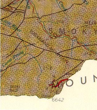
One of two igneous formations in TN, neither are visually significant. The red indicates the location of igneous rock near Clingman's Dome, off-trail. More outcroppings can be seen on the 155 MB pdf referenced here.
 (from Roadside Guide by Moore)
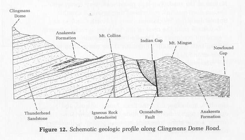
Norris lake igneous rock
Tennessee landforms
home
arches
waterfalls
rocks
peaks
balds
sinks
lakes
regions
county
GSMNP landforms (TN/NC)
BSF landforms (TN/KY)
or nearby
lookout towers
Chuck Sutherland's www.tnlandforms.com the future (2024)