Tennessee Landforms -- waterfalls| WGS84 |
| 35.622036 | -83.449374 |
| 35° 37.322'N | 83° 26.962'W |
| 35° 37' 19.3"N | 83° 26' 57.7"W |
| 17S 278173E 3944791N |
| convert to NAD27 |
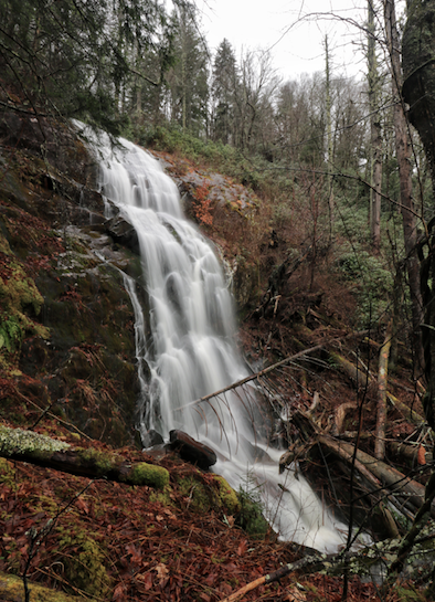
Grass Patch Br Falls 80'
Waypoint: SVF053 35.622036,-83.449374
County: Sevier landforms of Sevier county
Locale: Great Smoky Mountains National Park
popup list of
nearby landforms (mileage, bearing)
MAPS
Select one of the following maps to display this waypoint (WGS84).
GPS
Remarks:
Reference and photo: Brian Solomon
Tennessee landforms
home
arches
waterfalls
rocks
peaks
balds
sinks
lakes
regions
county
GSMNP landforms (TN/NC)
BSF landforms (TN/KY)
or nearby
lookout towers
Chuck Sutherland's www.tnlandforms.com the future (2024)
 ©
Tom Dunigan
©
Tom Dunigan