Tennessee Landforms -- waterfalls| WGS84 |
| 35.643000 | -83.482150 |
| 35° 38.58'N | 83° 28.929'W |
| 35° 38' 34.8"N | 83° 28' 55.7"W |
| 17S 275263E 3947191N |
| convert to NAD27 |
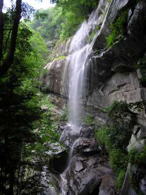
Fort Harry Falls 90'
Waypoint: SVF020 35.643000,-83.482150
County: Sevier landforms of Sevier county
Locale: Great Smoky Mountains National Park
popup list of
nearby landforms (mileage, bearing)
MAPS
Select one of the following maps to display this waypoint (WGS84).
GPS
Remarks:
A manway leads to this wet-weather falls
Also see Dutch Roth's
black&white
and winter
Tennessee landforms
home
arches
waterfalls
rocks
peaks
balds
sinks
lakes
regions
county
GSMNP landforms (TN/NC)
BSF landforms (TN/KY)
or nearby
lookout towers
Chuck Sutherland's www.tnlandforms.com the future (2024)
 ©
Tom Dunigan
©
Tom Dunigan