Tennessee Landforms -- waterfalls| WGS84 |
| 35.615400 | -83.470500 |
| 35° 36.924'N | 83° 28.23'W |
| 35° 36' 55.4"N | 83° 28' 13.8"W |
| 17S 276241E 3944102N |
| convert to NAD27 |
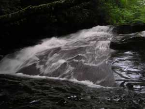
Talking Falls 15'
Waypoint: SVF017 35.615400,-83.470500
County: Sevier landforms of Sevier county
Locale: Great Smoky Mountains National Park
popup list of
nearby landforms (mileage, bearing)
MAPS
Select one of the following maps to display this waypoint (WGS84).
GPS
Remarks:
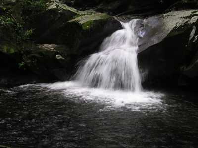
many other cascade along the way.
(
trail info)
Tennessee landforms
home
arches
waterfalls
rocks
peaks
balds
sinks
lakes
regions
county
GSMNP landforms (TN/NC)
BSF landforms (TN/KY)
or nearby
lookout towers
Chuck Sutherland's www.tnlandforms.com the future (2024)
 ©
Tom Dunigan
©
Tom Dunigan