Tennessee Landforms -- arches and natural bridges| WGS84 |
| 35.936700 | -83.686300 |
| 35° 56.202'N | 83° 41.178'W |
| 35° 56' 12.1"N | 83° 41' 10.7"W |
| 17S 257669E 3980263N |
| convert to NAD27 |
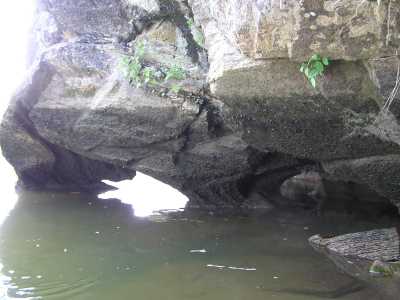
Seven Islands Arches 4x2
Waypoint: SVA004 35.936700,-83.686300
County: Sevier landforms of Sevier county
NABSQNO 17S-257669-3980263
popup list of
nearby landforms (mileage, bearing)
MAPS
Select one of the following maps to display this waypoint (WGS84).
GPS
Remarks:
A pair of small arches viewable by canoe. Another smaller window
100' downstream.
If French Broad is high, these arches are submerged.
Tennessee landforms
home
arches
waterfalls
rocks
peaks
balds
sinks
lakes
regions
county
GSMNP landforms (TN/NC)
BSF landforms (TN/KY)
or nearby
lookout towers
Chuck Sutherland's www.tnlandforms.com the future (2024)
 ©
Tom Dunigan
©
Tom Dunigan