| WGS84 | |
| 36.384100 | -87.655500 |
| 36° 23.046'N | 87° 39.33'W |
| 36° 23' 2.8"N | 87° 39' 19.8"W |
| 16S 441209E 4026752N | |
| convert to NAD27 | |
MAPS
Select one of the following maps to display this waypoint (WGS84).
GPS
Remarks:
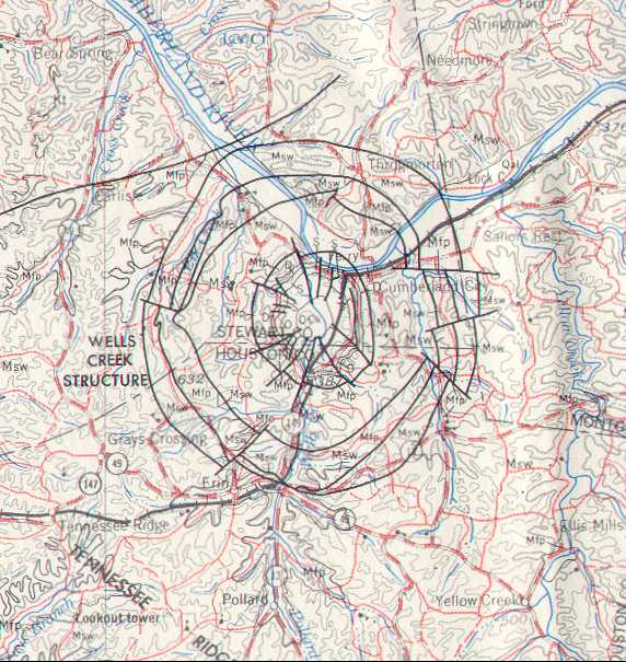
MTSU pictures at Wells Creek Also see Wilson/Stearns 1968 bulletin, Geology of the Wells Creek Structure and Wells Creek shattercones and earth impact DEM image More info on Wells Creek crater or Wells Creek Impact Crater 2011
TN craters (not visually significant): Howell Crater or Flynn Creek Crater or Wells Creek Crater or Dycus Crater