Tennessee Landforms -- rock formations| WGS84 |
| 35.160900 | -85.387000 |
| 35° 9.654'N | 85° 23.22'W |
| 35° 9' 39.2"N | 85° 23' 13.2"W |
| 16S 646907E 3892078N |
| convert to NAD27 |
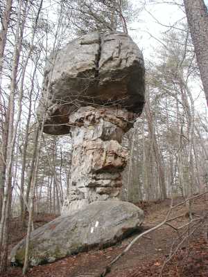
Mushroom Rock 20'
Waypoint: SQR001 35.160900,-85.387000
County: Sequatchie landforms of Sequatchie county
Locale: Cumberland Trail
popup list of
nearby landforms (mileage, bearing)
MAPS
Select one of the following maps to display this waypoint (WGS84).
GPS
Remarks:
Tennessee landforms
home
arches
waterfalls
rocks
peaks
balds
sinks
lakes
regions
county
GSMNP landforms (TN/NC)
BSF landforms (TN/KY)
or nearby
lookout towers
 ©
Tom Dunigan
©
Tom Dunigan