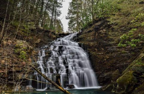
 Mikes Creek falls 40' (aka Redbeard Falls)
| WGS84 | |
| 35.180170 | -85.383080 |
| 35° 10.81'N | 85° 22.985'W |
| 35° 10' 48.6"N | 85° 22' 59.1"W |
| 16S 647229E 3894221N | |
| convert to NAD27 | |
MAPS
Select one of the following maps to display this waypoint (WGS84).
GPS
Remarks:
Reference and photos: Christopher Lewis and Daniel Jack Hutchison
Mikes Creek falls 40' (aka Redbeard Falls)
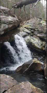 lower Mike Creek falls 15', about 500' downstream at
35.179525, -85.38457
lower Mike Creek falls 15', about 500' downstream at
35.179525, -85.38457