Tennessee Landforms -- rock formations| WGS84 |
| 36.509700 | -84.640000 |
| 36° 30.582'N | 84° 38.4'W |
| 36° 30' 34.9"N | 84° 38' 24"W |
| 16S 711342E 4043074N |
| convert to NAD27 |
Grand Gap Chimney 35'
Waypoint: SCR011 36.509700,-84.640000
County: Scott landforms of Scott county
Locale: Big South Fork
popup list of
nearby landforms (mileage, bearing)
MAPS
Select one of the following maps to display this waypoint (WGS84).
GPS
Remarks:
Reference & photo: Keith Garnes
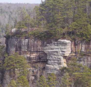 view from Grand Gap Loop trail
Tennessee landforms
home
arches
waterfalls
rocks
peaks
balds
sinks
lakes
regions
county
GSMNP landforms (TN/NC)
BSF landforms (TN/KY)
or nearby
lookout towers
Chuck Sutherland's www.tnlandforms.com the future (2024)
 ©
Tom Dunigan
©
Tom Dunigan