Tennessee Landforms -- rock formations| WGS84 |
| 36.557206 | -84.659228 |
| 36° 33.432'N | 84° 39.554'W |
| 36° 33' 25.9"N | 84° 39' 33.2"W |
| 16S 709491E 4048303N |
| convert to NAD27 |
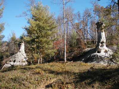
Station Camp Chimneys 25'
Waypoint: SCR004 36.557206,-84.659228
County: Scott landforms of Scott county
Locale: Big South Fork
popup list of
nearby landforms (mileage, bearing)
MAPS
Select one of the following maps to display this waypoint (WGS84).
GPS
Remarks:
Tennessee landforms
home
arches
waterfalls
rocks
peaks
balds
sinks
lakes
regions
county
GSMNP landforms (TN/NC)
BSF landforms (TN/KY)
or nearby
lookout towers
Chuck Sutherland's www.tnlandforms.com the future (2024)
 ©
Tom Dunigan
©
Tom Dunigan