Tennessee Landforms -- waterfalls| WGS84 |
| 36.450476 | -84.661751 |
| 36° 27.029'N | 84° 39.705'W |
| 36° 27' 1.7"N | 84° 39' 42.3"W |
| 16S 709553E 4036456N |
| convert to NAD27 |
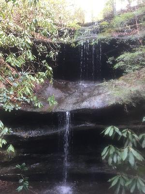
Diocese Falls 25'
Waypoint: SCF044 36.450476,-84.661751
County: Scott landforms of Scott county
Locale: Big South Fork
popup list of
nearby landforms (mileage, bearing)
MAPS
Select one of the following maps to display this waypoint (WGS84).
GPS
Remarks:
Reference and photo: Chad Harrold
Tennessee landforms
home
arches
waterfalls
rocks
peaks
balds
sinks
lakes
regions
county
GSMNP landforms (TN/NC)
BSF landforms (TN/KY)
or nearby
lookout towers
Chuck Sutherland's www.tnlandforms.com the future (2024)
 ©
Tom Dunigan
©
Tom Dunigan