Tennessee Landforms -- waterfalls| WGS84 |
| 36.472484 | -84.648815 |
| 36° 28.349'N | 84° 38.929'W |
| 36° 28' 20.9"N | 84° 38' 55.7"W |
| 16S 710653E 4038926N |
| convert to NAD27 |
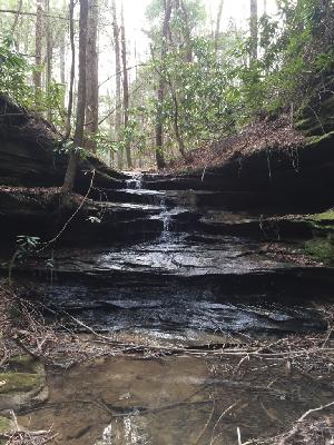
Staircase Falls 11'
Waypoint: SCF040 36.472484,-84.648815
County: Scott landforms of Scott county
Locale: Big South Fork
popup list of
nearby landforms (mileage, bearing)
MAPS
Select one of the following maps to display this waypoint (WGS84).
GPS
Remarks:
Reference and photo: Chad Harrold
Tennessee landforms
home
arches
waterfalls
rocks
peaks
balds
sinks
lakes
regions
county
GSMNP landforms (TN/NC)
BSF landforms (TN/KY)
or nearby
lookout towers
Chuck Sutherland's www.tnlandforms.com the future (2024)
 ©
Tom Dunigan
©
Tom Dunigan